On the windy southern shores of Lake Superior, there are 42 miles of some of the most beautiful and diverse landscapes in the country. From towering cliffs, cascading waterfalls, and rolling sand dunes, to dense forests, and beautiful beaches. It is hard to believe that the most magical place, Pictured Rocks National Lakeshore, is in my state. It is a part of the National Park system. Pictured Rocks National Lakeshore includes 114 square miles of protected areas, stretching from the town of Munising to the town of Grand Marais. In 1966, Congress designated the Pictured Rocks National Lakeshore the first national Lakeshore.
Visitors have many ways to see the sites at the Pictured Rocks, from over 100 miles of back country trails to kayaking and guided boat tours. I spent two days exploring the Picture Rocks National Lakeshore. On the first day I stayed on the land, driving from Munising to Grand Marais, stopping at the sites along the way. The winding country roads through the woods, make for an exciting drive. On the second day, I went on the Pictured Rocks Cruise to see the 15 miles of sandstone cliffs. I checked the weather forecast a few days ahead of time to see which day would be a better weather day for the boat tour, then made a reservation.
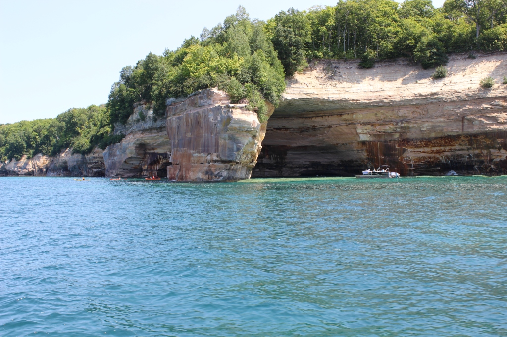
The Pictured Rocks has varying degrees of difficulty for accessing various sites to see. For example, some of the waterfalls, beaches and overlooks have convenient parking lots with short walks down paths to reach them, - the easier variety. On the more difficult range, there were two waterfalls I didn’t see because the park rangers didn’t recommend anyone drive down the dirt road because it was in rough shape. In addition to the rough road, there was a longer, more advanced hike to reach the waterfalls. Each of the two waterfalls was a 25-minute walk from the nearest parking lots. This also applies to the water. The easiest way to see the Pictured Rocks is to take the Pictured Rocks Cruises guided tours. More adventurous options are kayaking along the cliffs or renting your own pontoon boat.
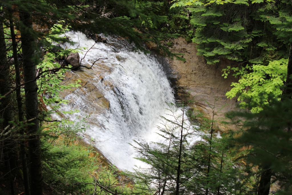
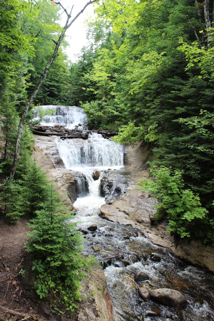
For my day of land adventures, I started off in Munising and made my way east to Grand Marais. My first stop was the Munising Falls, located just outside of town at the beginning of the National Lakeshore area. Park at the visitor center lot and take a short quarter of a mile walk on a paved path to this 50-foot waterfall. The water cascades over sandstone cliffs among the trees.
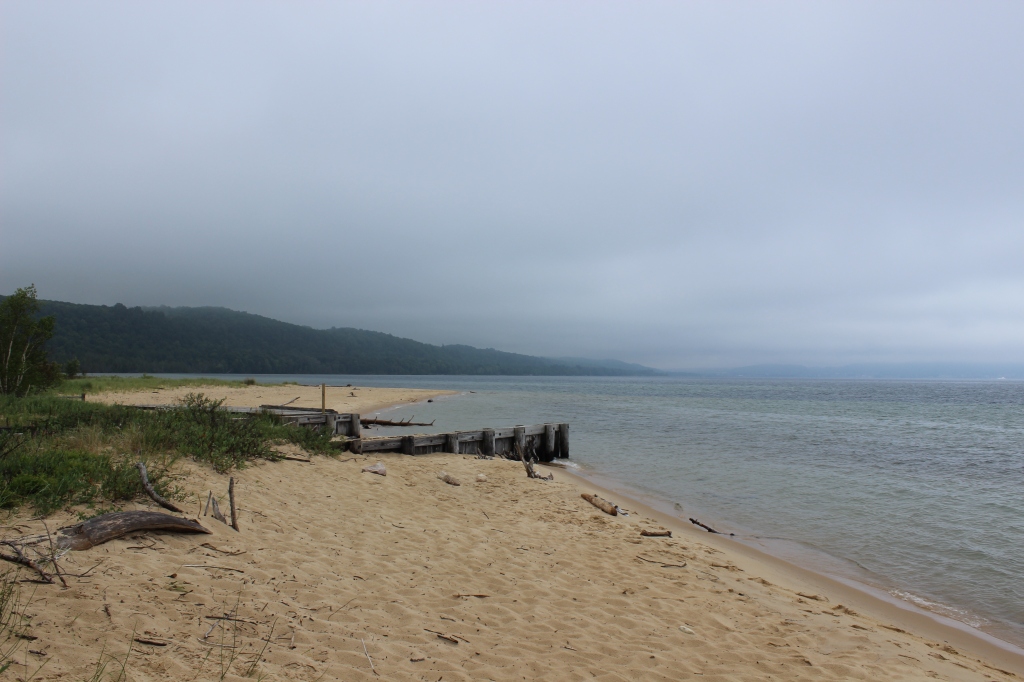
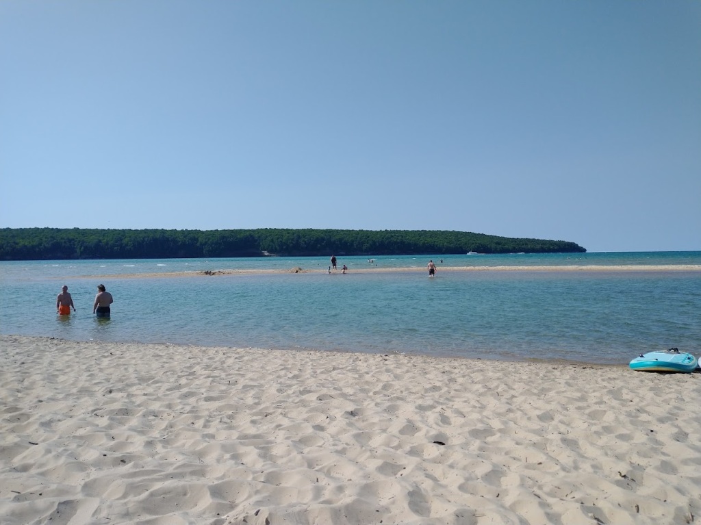
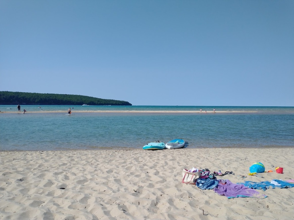
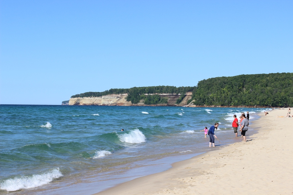
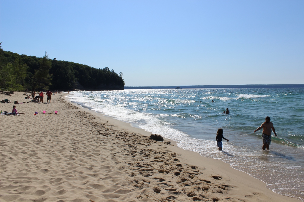
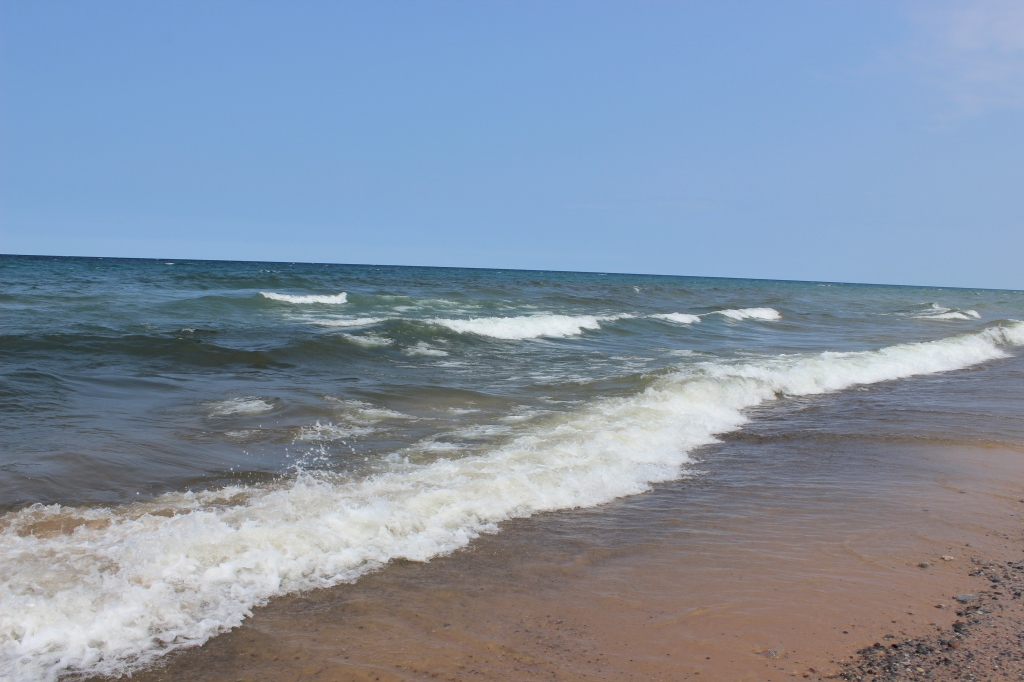
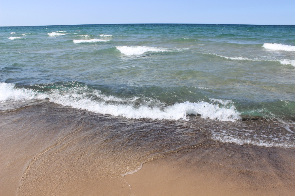
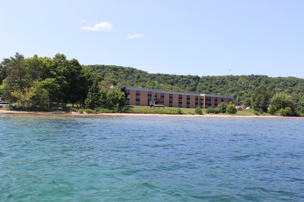
I jumped back in the car and five minutes up the road I arrived Sand Point Beach, located at the park headquarters. Sand Point Beach is unique because it has a shallow sand bar that extends a few hundred feet out into Munising Bay surrounded by deep water. You can walk out and get close to boats -just watch the drop-off, it gets deep quick. The sand bar is very visible from the boat tour. The first day I went, it was very foggy, and Grand Island and Munising were shrouded in the fog. Thankfully, the next day the weather was perfect, so I spent the afternoon swimming at Sand Point Beach. Lake Superior was warmer than expected, which was a pleasant surprise (I went in mid-July). Michigan weather changes rapidly -the first day it was foggy and rainy, then the next day there was sunshine and perfectly clear blue skies. A great place to cool off and relax.

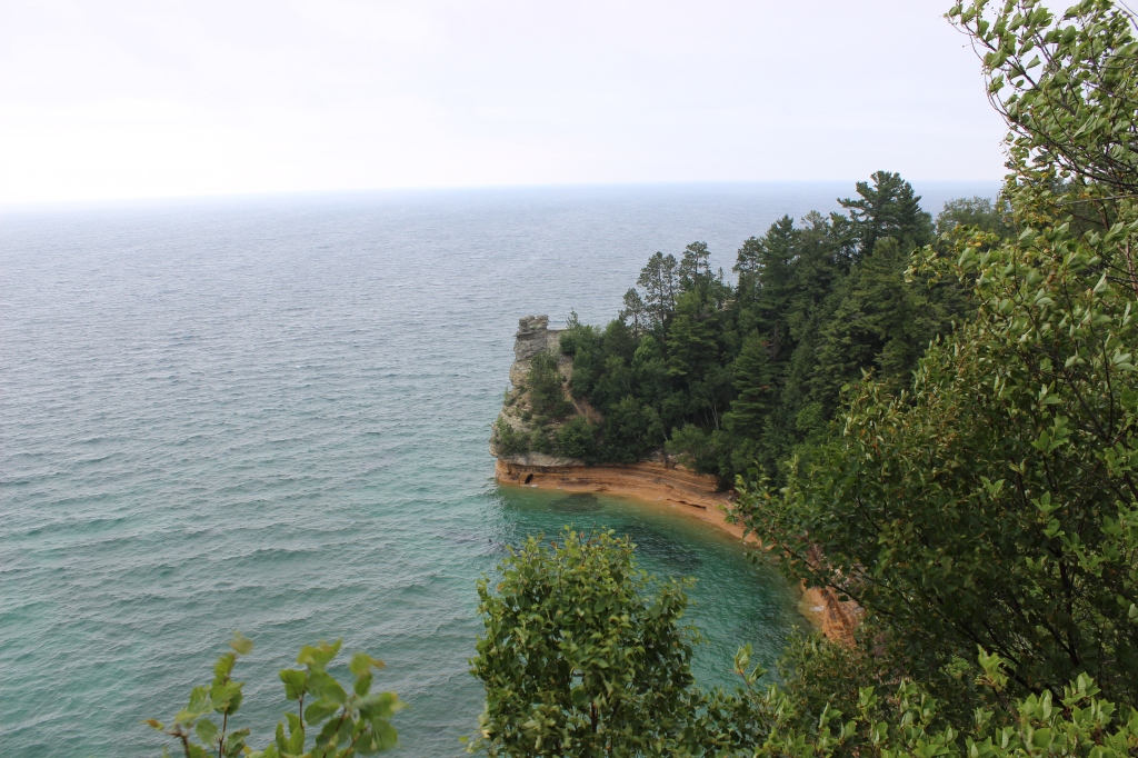
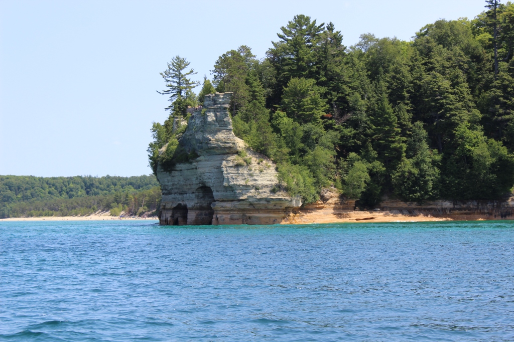
Back in the car to the next stop exploring the Pictured Rocks is Miner’s Castle. This is one of the most famous landmarks of the Pictured Rocks Lakeshore. You will probably see it on a postcard. A short walk from the parking lot is the upper overlook to see the great panorama of the Miner’s Castle and Lake Superior. Take a short walk to the lower overlook to get a closer look at the rock formation. The Pictured Rocks Cruises come by Miner’s Castle on their tour. Even when the weather isn’t the greatest, the colors of Lake Superior are still majestic.
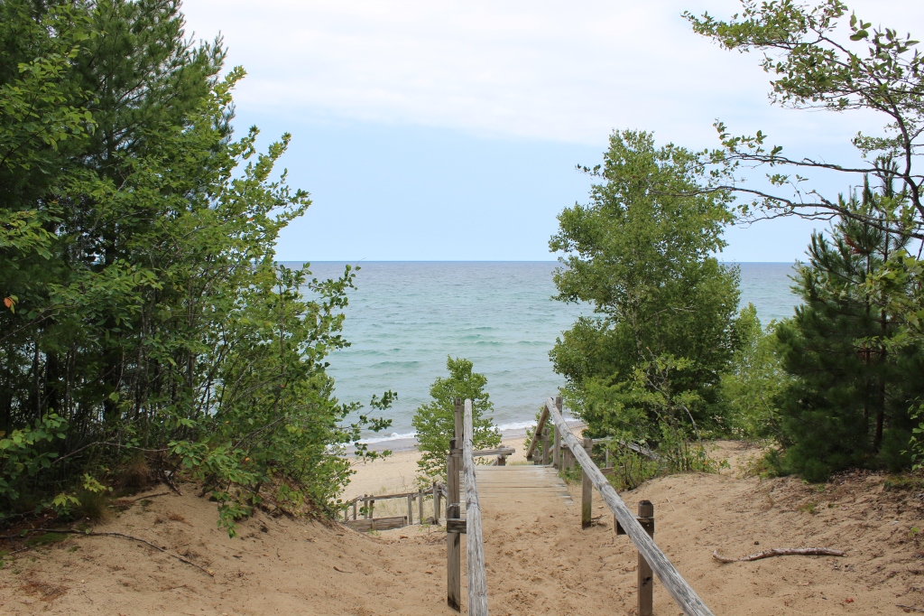
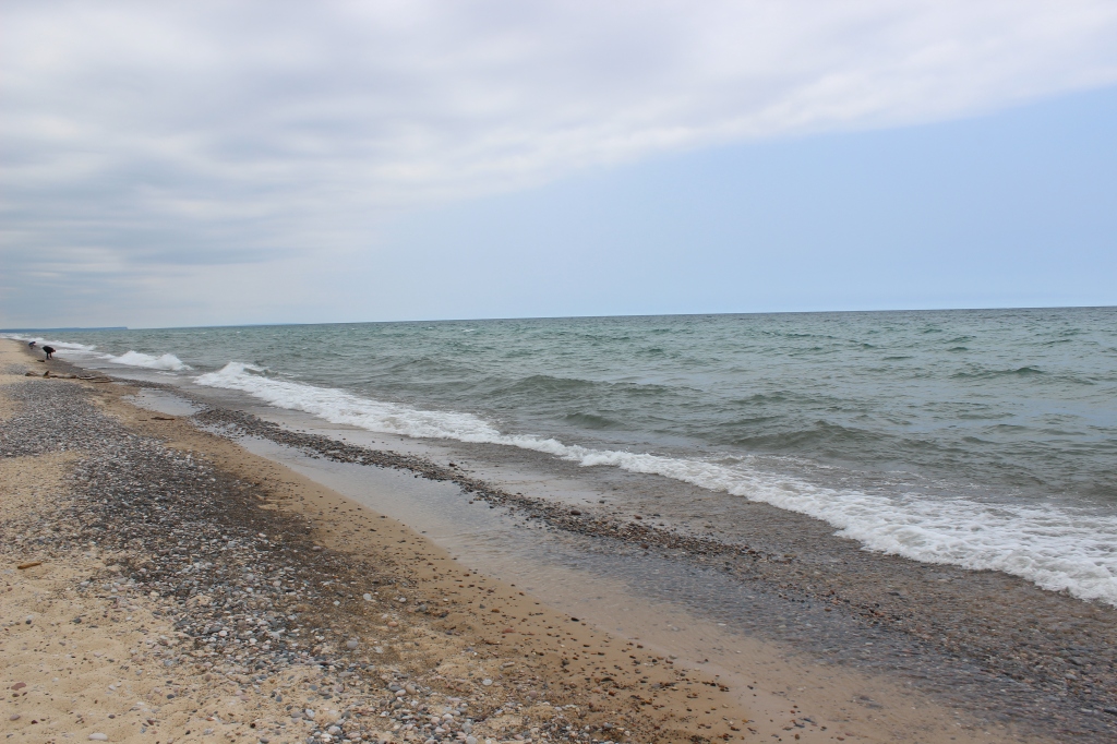
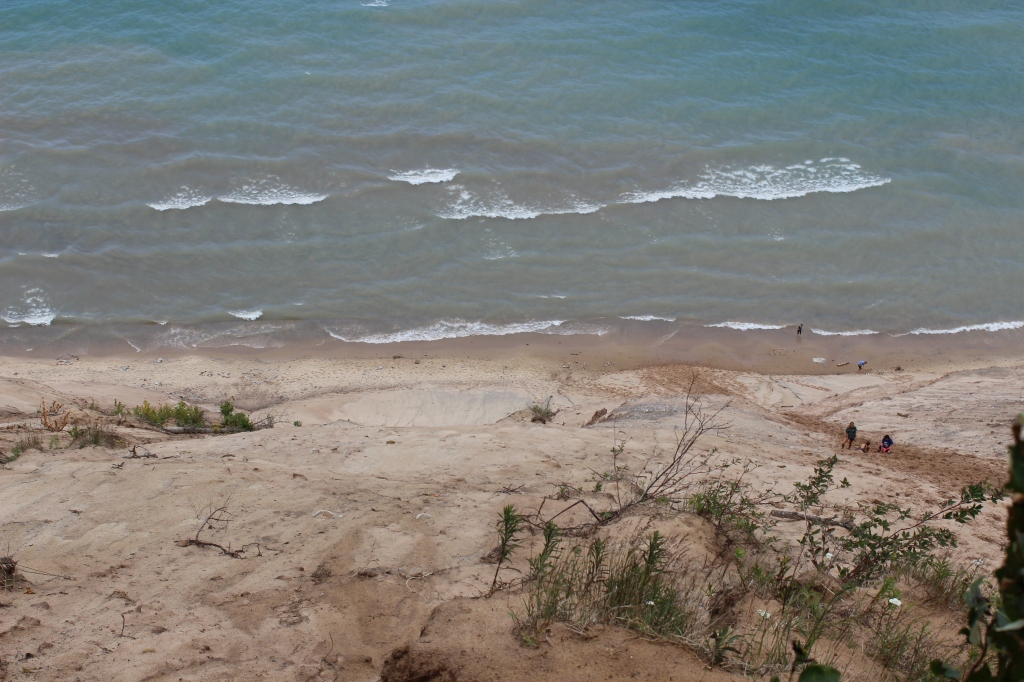
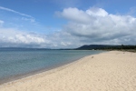
Just on the other side of the cliff, is Miner’s Beach, a break in the sandstone cliffs. After a short walk through the woods, it opens to a white sand beach with cliff views in both directions and Grand Island off to the west. It was cloudy the first time I visited, but it cleared up later that afternoon on my way back to Munising. This is one of the most beautiful beaches I have ever seen.


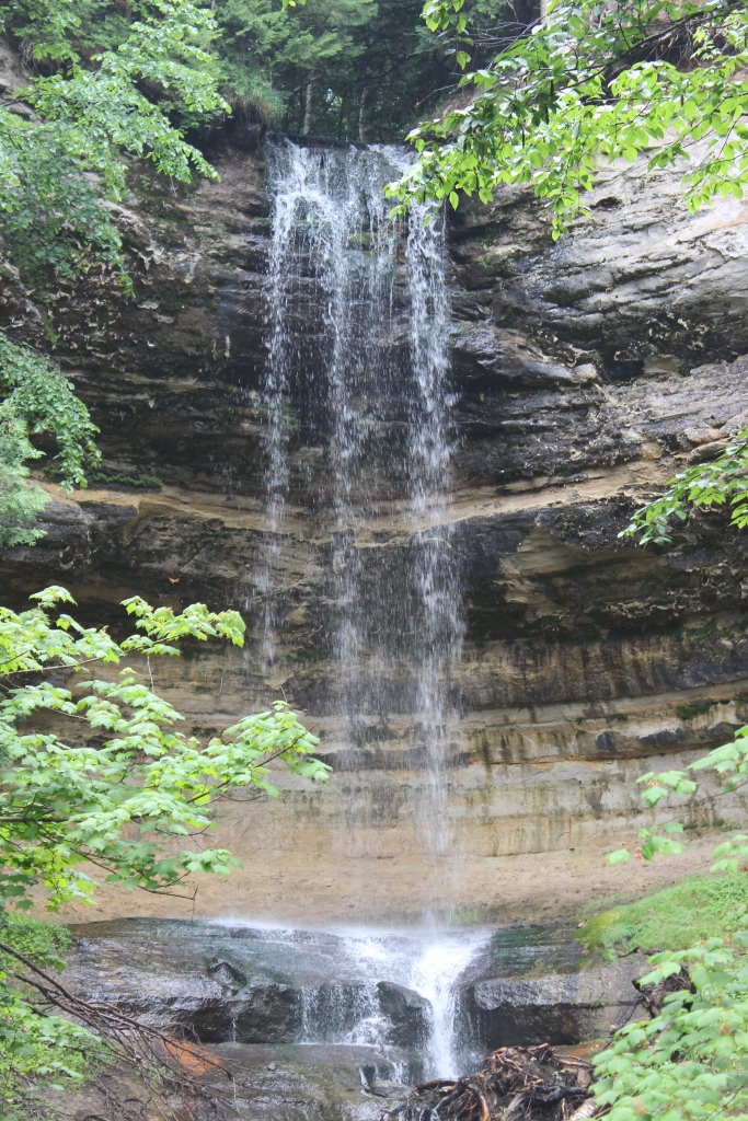
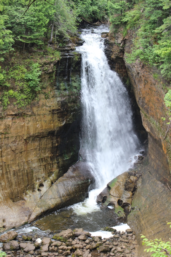
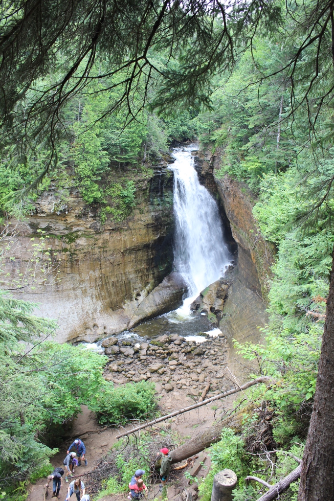
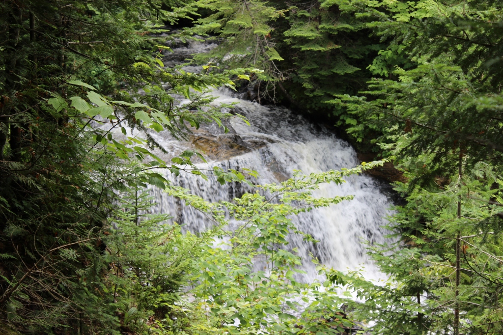
In the same vicinity of Miner’s Beach and Castle, there is, you guessed it, Miner’s Falls. This waterfall is a little more advanced than Munising Falls. Take a half mile walk through the woods and down some stairs and you will find this 50-foot cascade between the cliffs. You’ll hear it before you see it. Up for more adventure? Climb off the wooden stairway and you can get even closer to the waterfall.
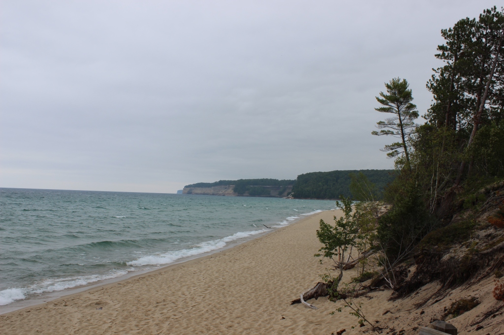
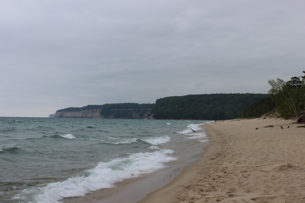
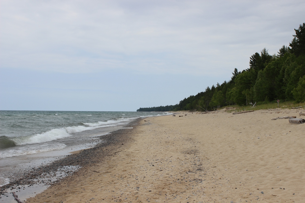
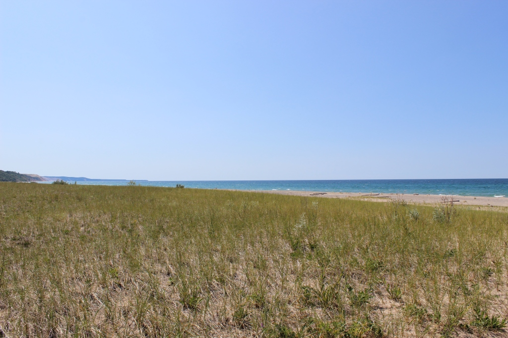
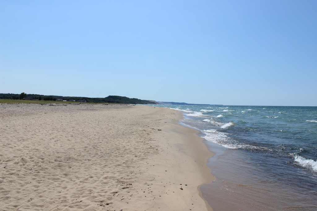
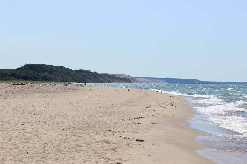
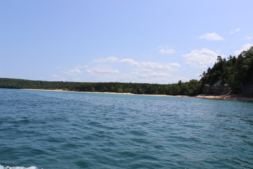
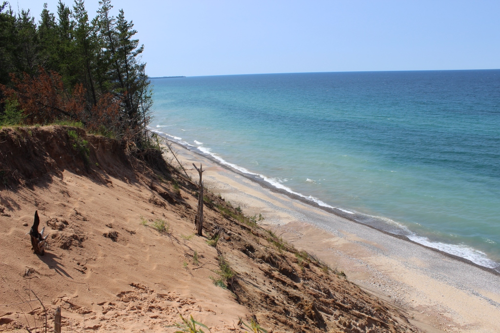
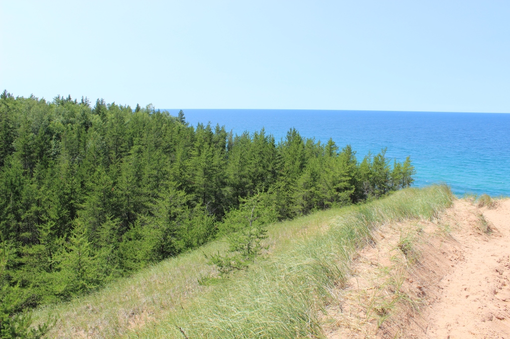
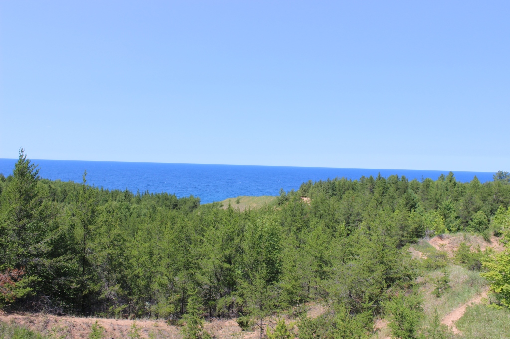
After a group of relatively close sites, the next stop is a 45-minute winding drive through the forest to Twelve Mile beach, which you guess it, is 12 miles of uninterrupted beaches along the shores of Lake Superior. The beach is a short walk from the parking lot. I bet the best way to see Twelve Mile Beach is by hiking the Lakeshore-North Country Trail. Twelve Mile Beach is an excellent example of undisturbed natural beach. Make your adventure as big or as small as you want.
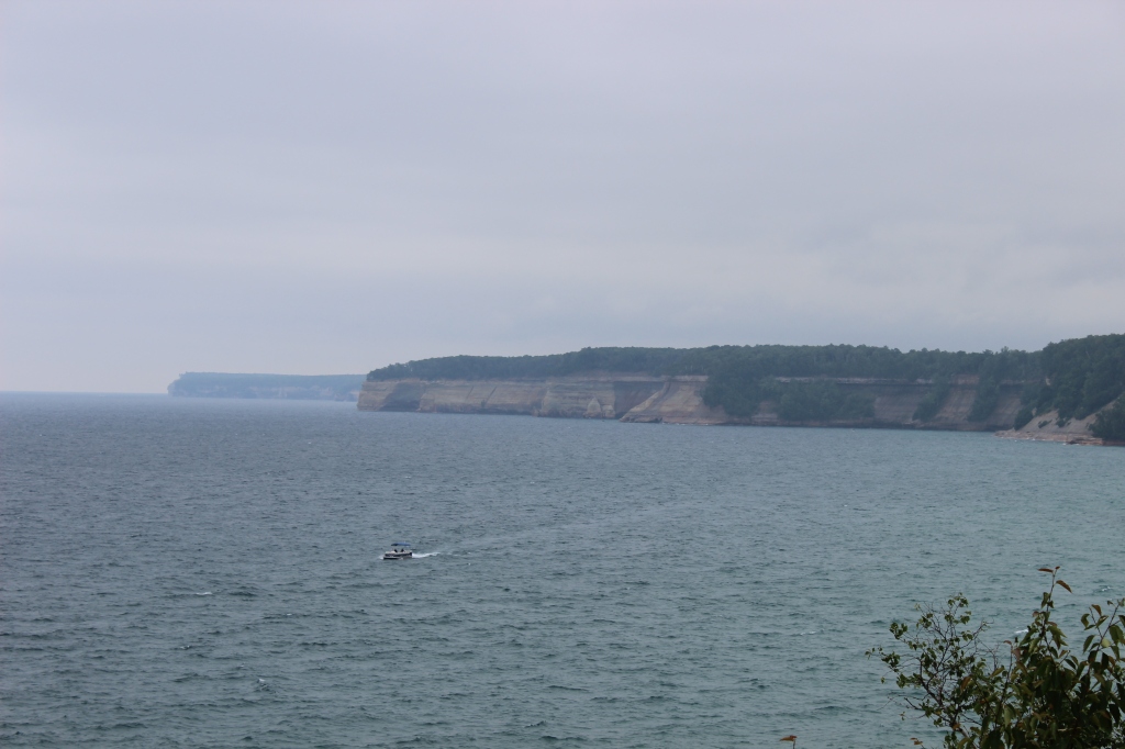
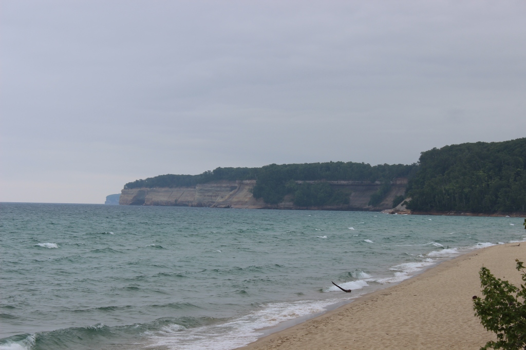
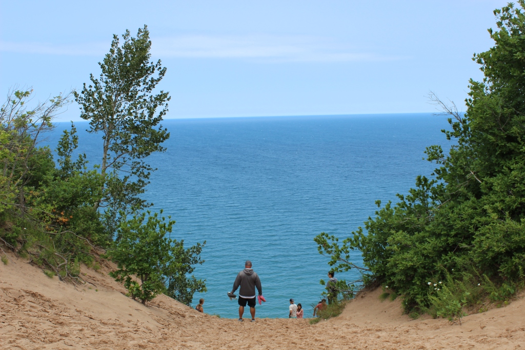
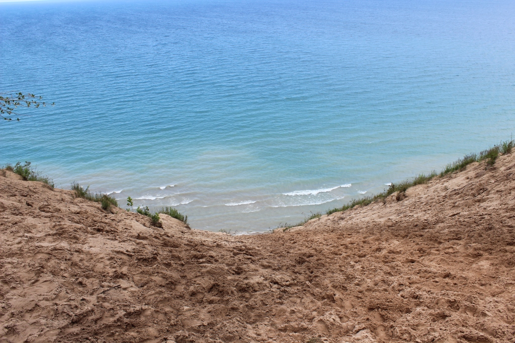
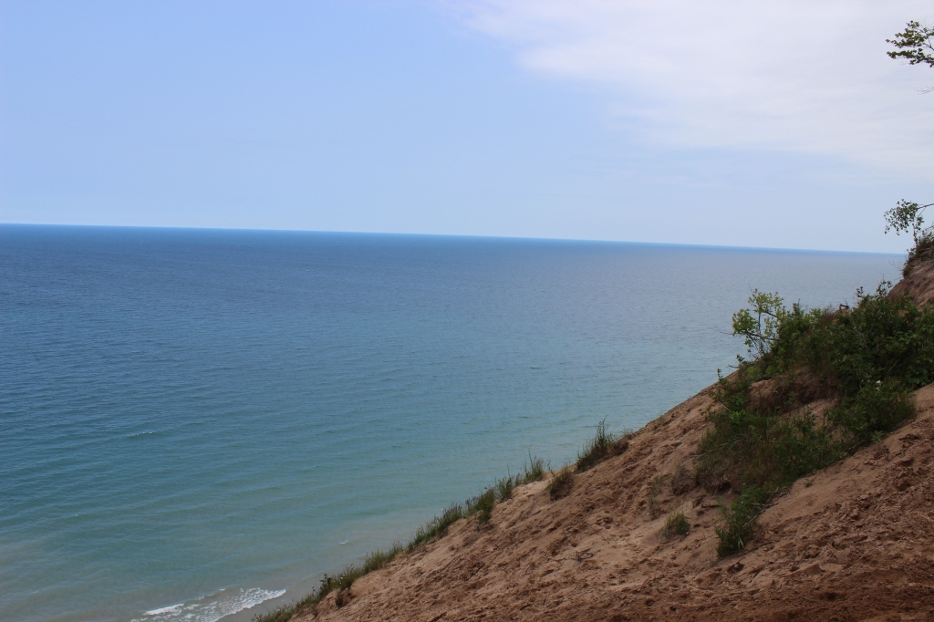
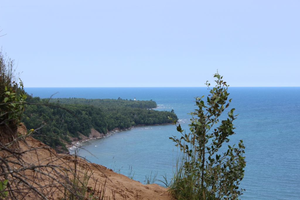
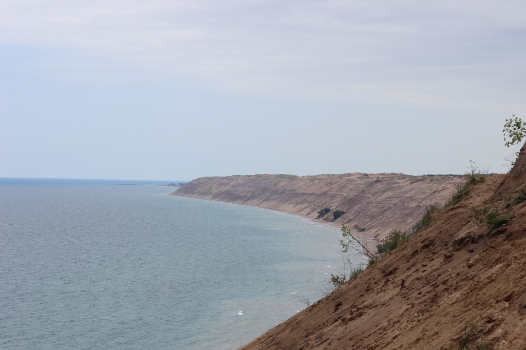
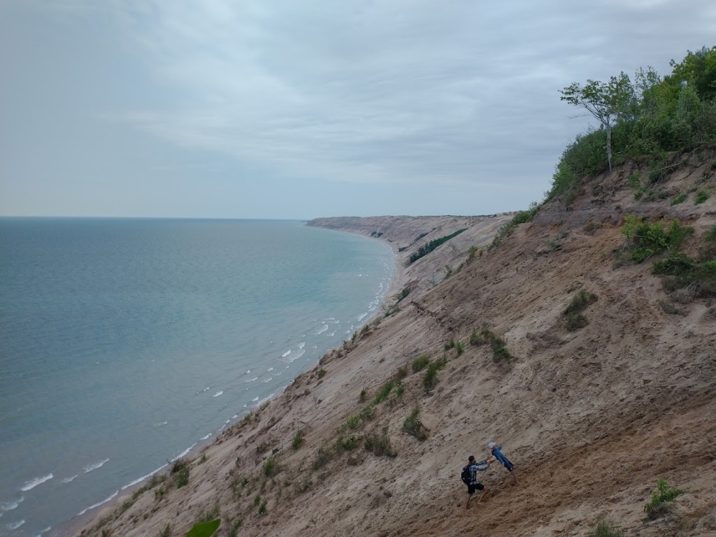
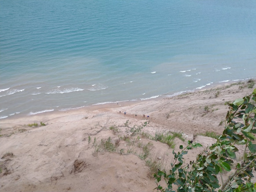
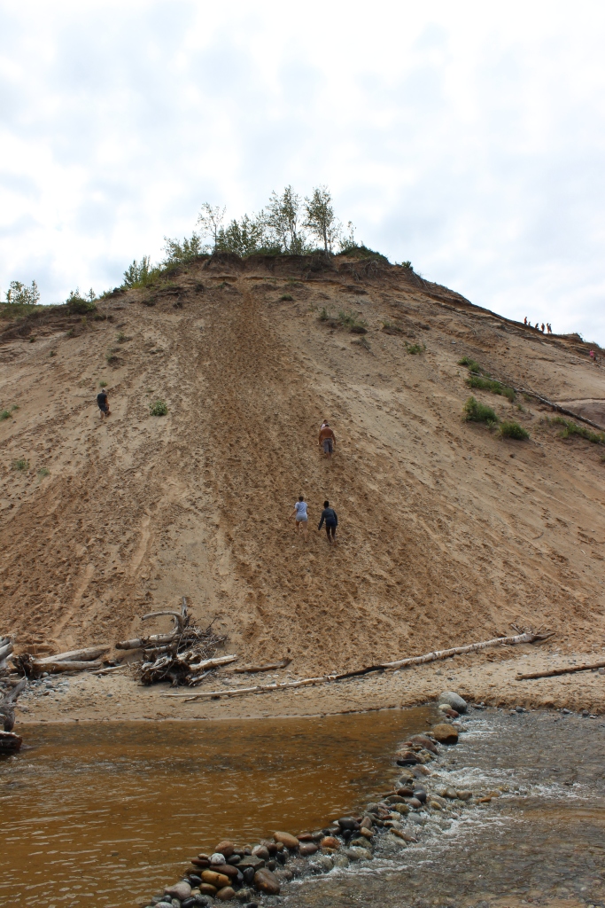
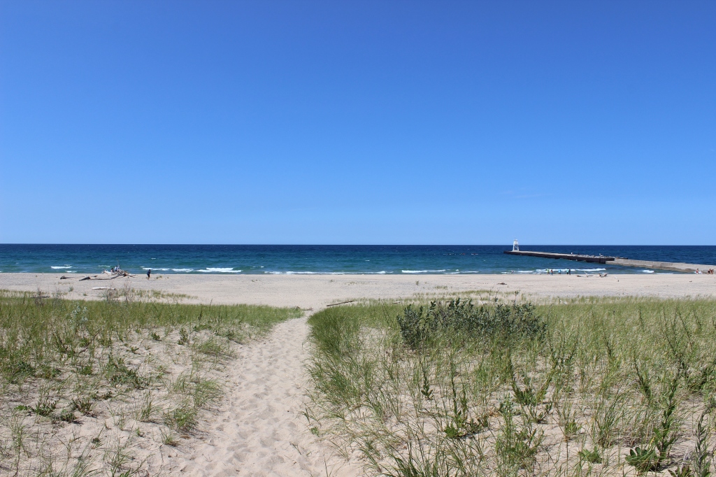
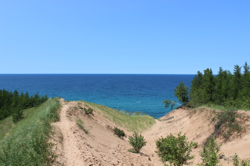
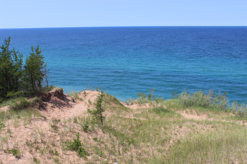
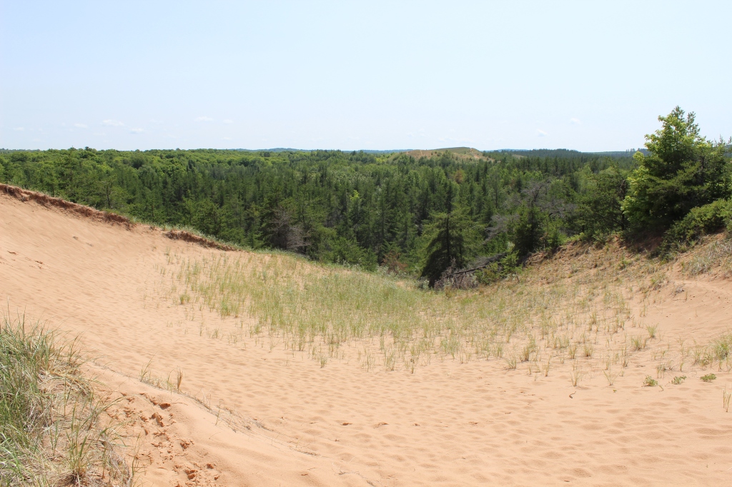
The Pictured Rocks National Lakeshore has many amazing vistas to take in nature’s beauty. One of the best is Log Slide Overlook. Sitting 175 feet above Lake Superior, the Log Slide Overlook has some of the best views in the park. First, after a short walk from the parking lot, the majestic beauty and power of Lake Superior take your breath away. Looking to the left, off to the northwest, you will see the Au Sable Light Station. Look to your right, (east) and you will see the impressive Grand Sable Sand Dune. Look down and you will see the steep trek down to the water. A quick scamper down can be a laborious hike back up the hill. Back in the 19th century, when the logging industry was prevalent in the area, loggers would roll logs down the sand dune to the lake for easy transport. This is a must-see stop when visiting the Pictured Rocks or the Upper Peninsula.
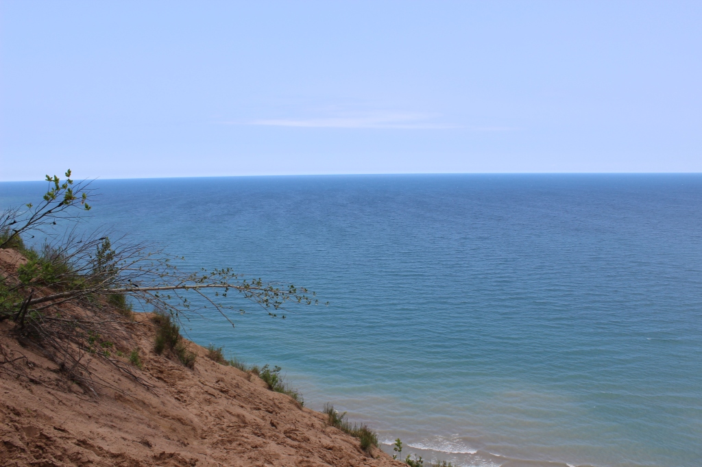
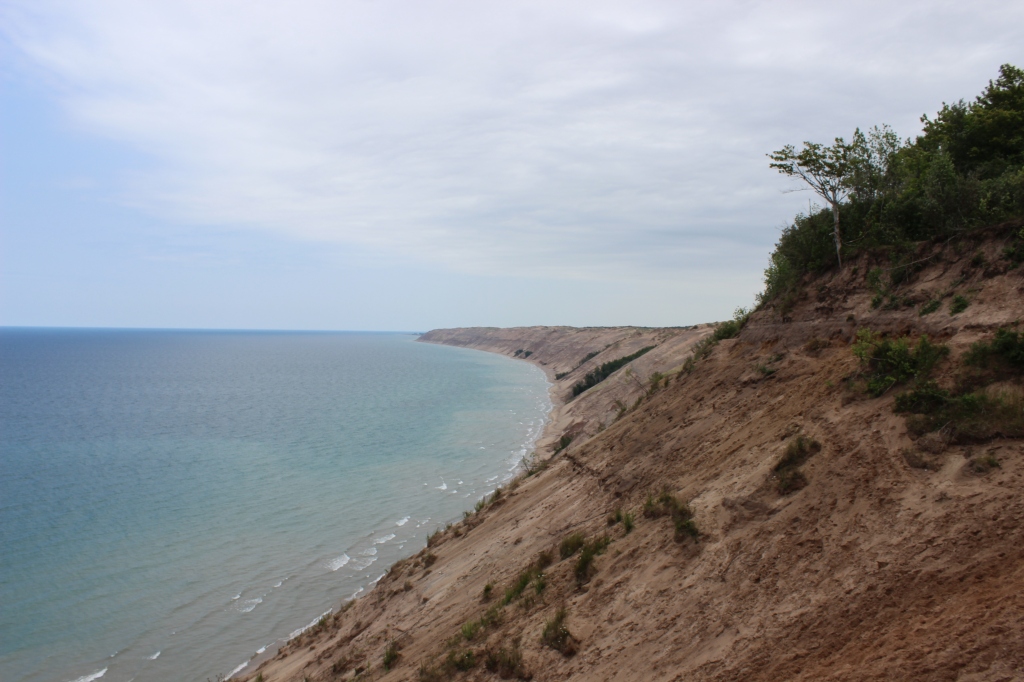

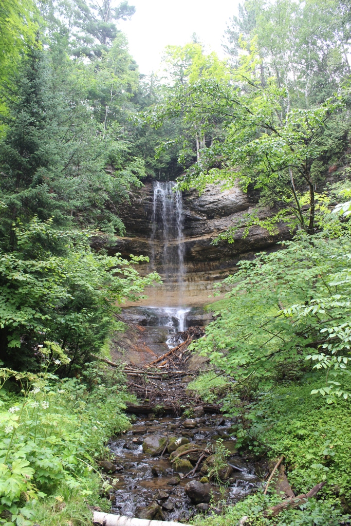
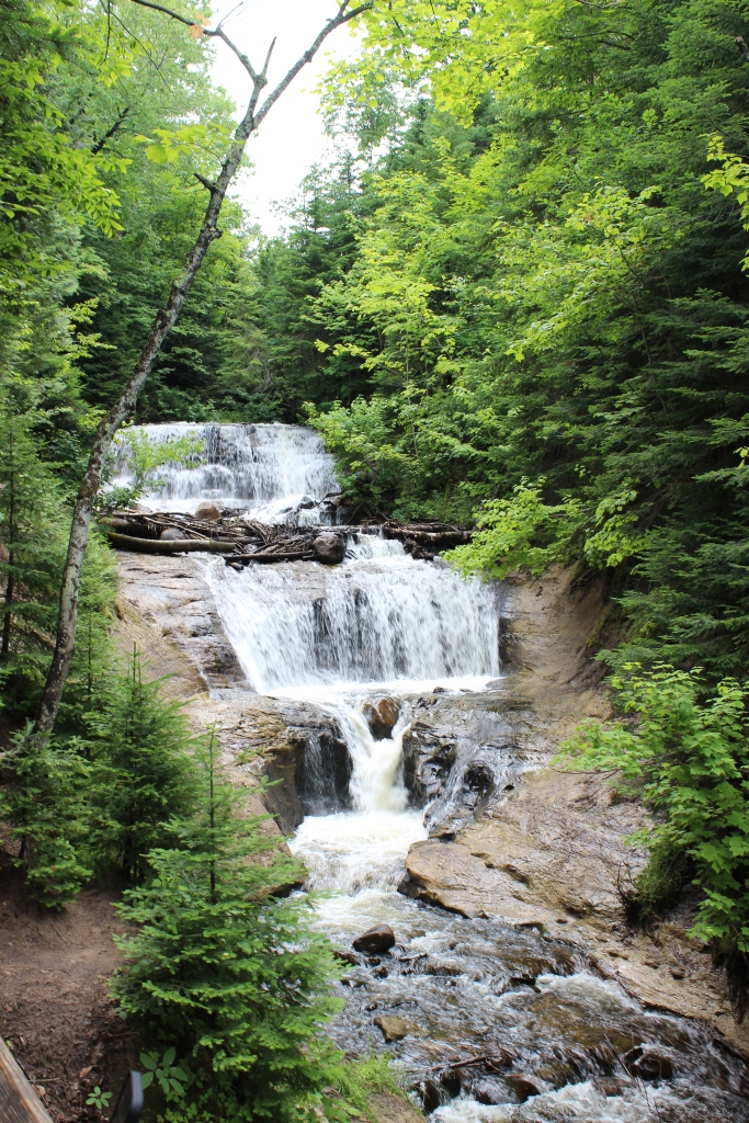
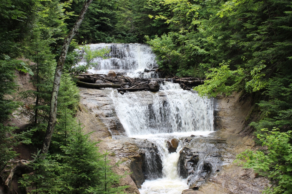
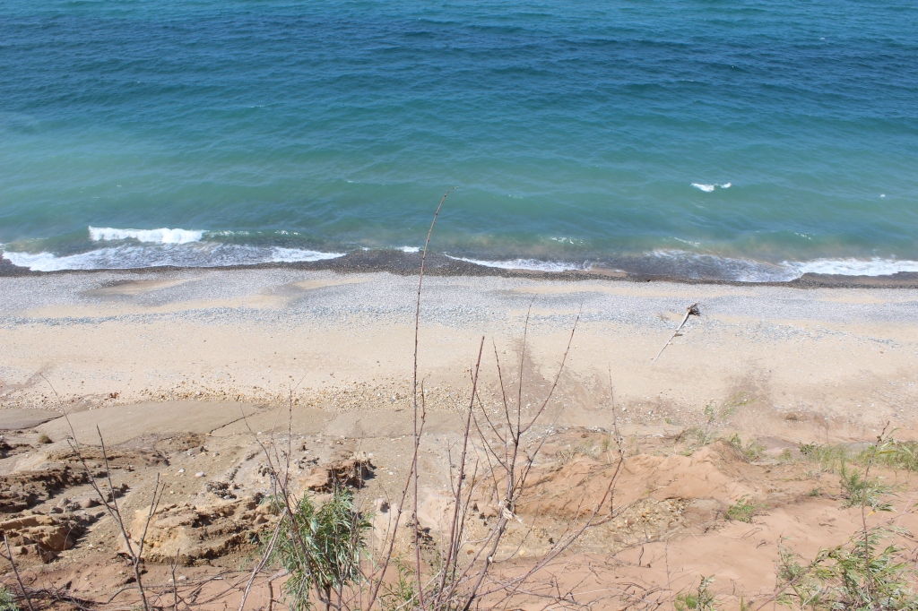
Follow up those amazing views with a little adventure. At the other end of the Grand Sable Dunes, is the Sable Falls. Go down the trail and169 stairs, to find the falls, cascading down 75 feet, with a few drops. Follow the water and the trail out to Sable Beach as Sable Creek empties out into Lake Superior. Wade across the creek and you can climb up the side of the Grand Sable Sand Dunes. Not up for such an intense workout? Take in the sights of the sand dunes and Lake Superior.

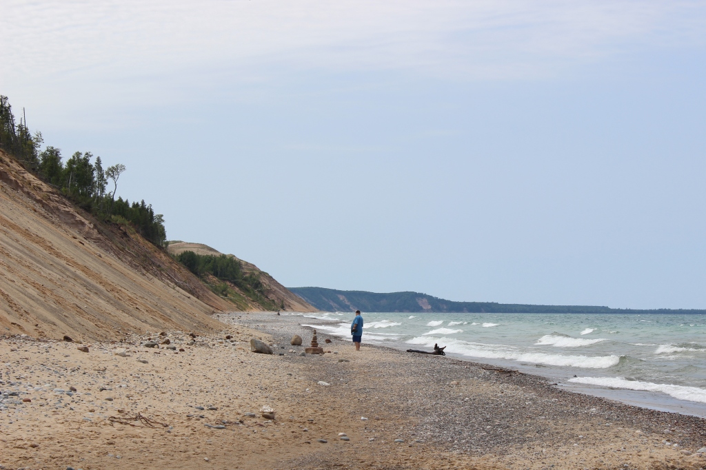
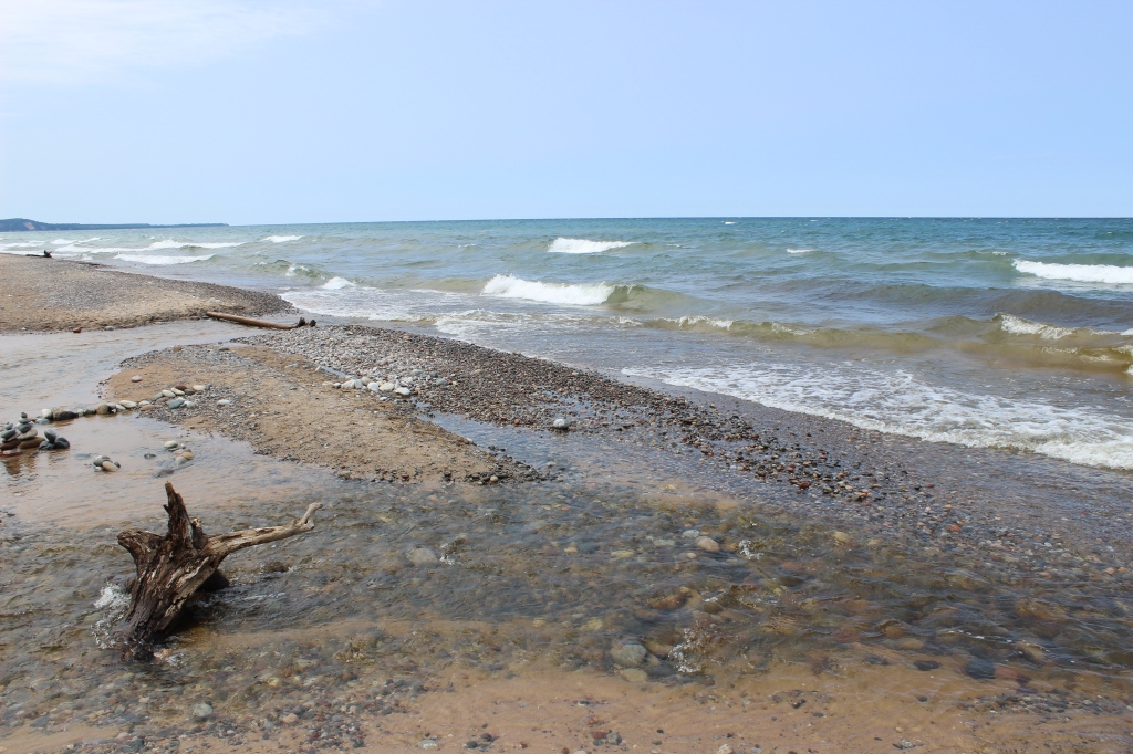
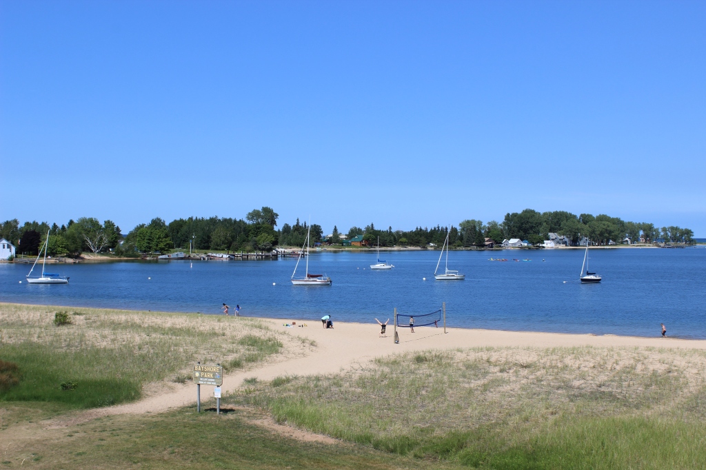
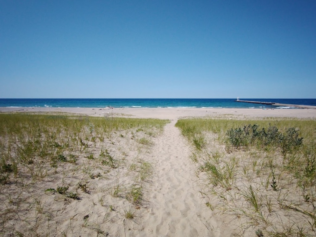
If you have made it this far, go a little further to the town of Grand Marais to get some food for your hungry self and gasoline for your thirsty car because it is about an hour drive back to Munising. Grand Marais is gorgeous as well. There is an idyllic bay with some small boats and the public beach on Lake Superior is spectacular. The beach looks like what I imagine a lot of beaches in the Outer Banks of North Carolina look like (although I have never been). I am going to write another article just on the beach in Grand Marais.
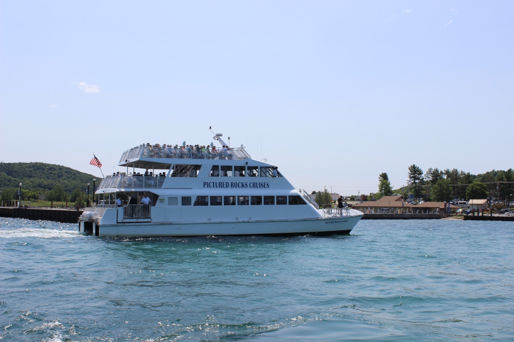
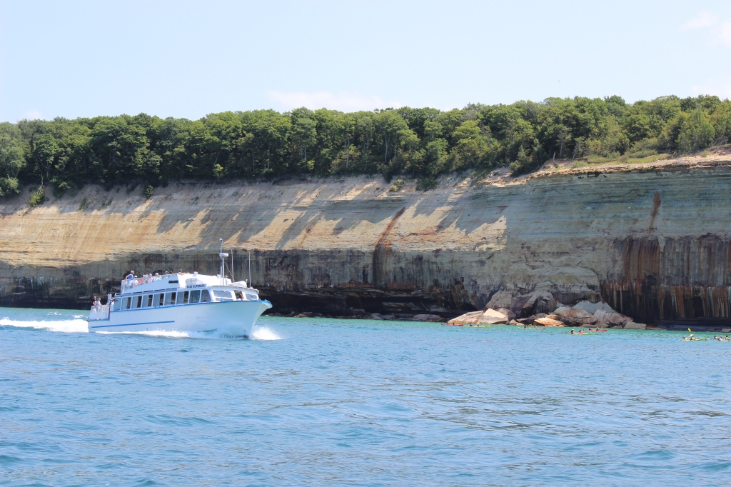
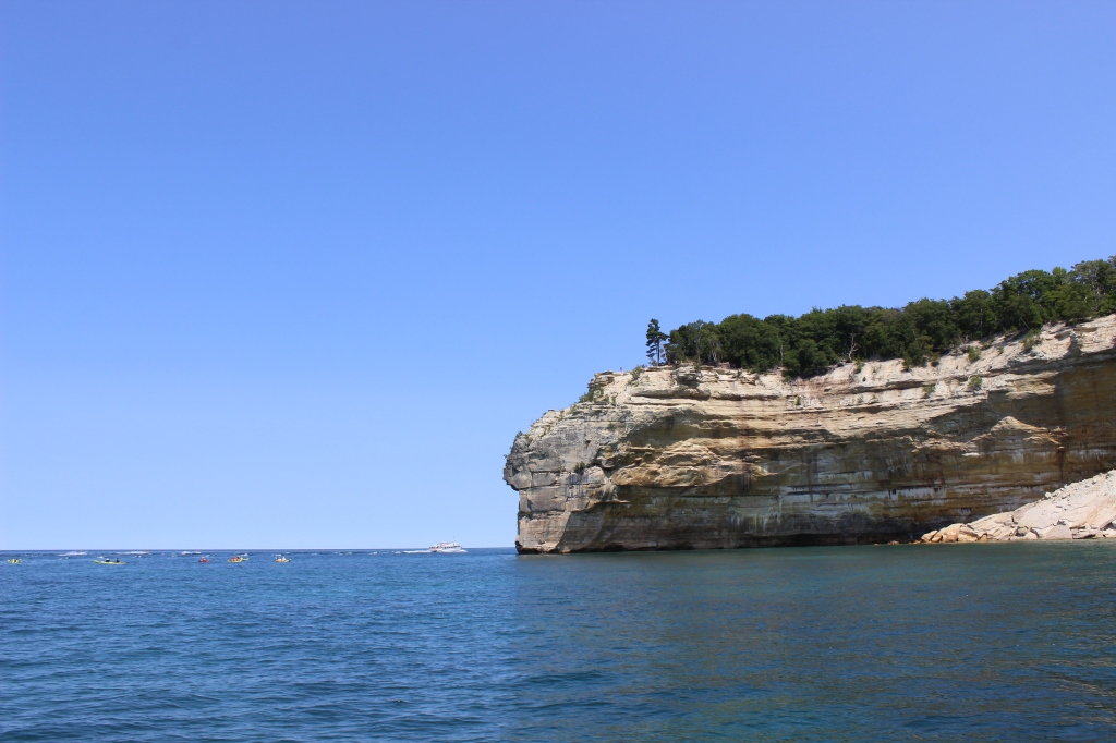
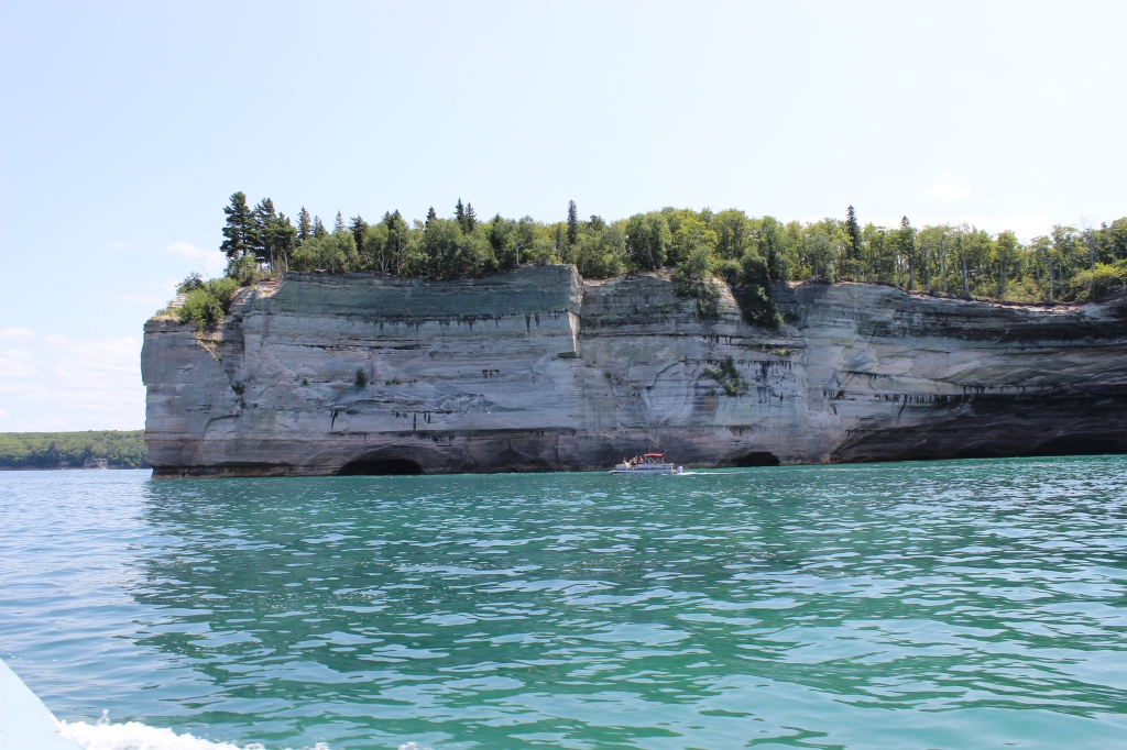
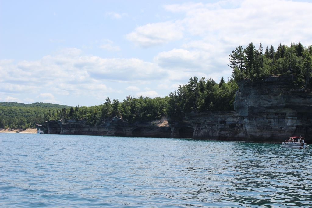
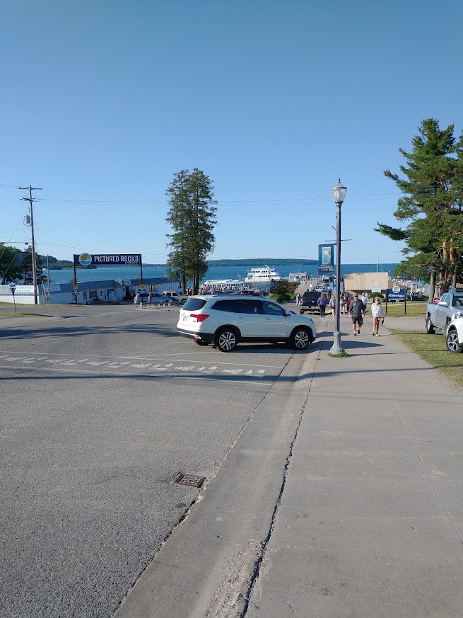
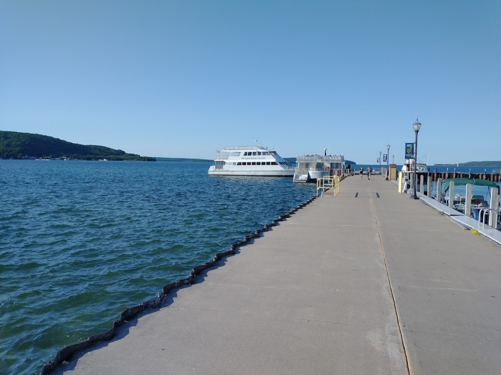
Now for the main event you have all been waiting for, the Pictured Rocks Boat Tour Cruise. The best way to see the cliffs of the Pictured Rocks is via water. To get up close and personal with the Pictured Rocks, you can rent a pontoon boat or kayak. Just watch out for falling rock. The week before I went, there was a major rock formation collapse, caught on video that went viral online. The most popular means of transportation and the main reason a lot of people visit the Pictured Rocks is the Pictured Rocks Cruises. They offer a few different cruise options throughout the day, spring through the fall. Their cruises are two and half hours long going 32 miles round trip. When planning your own trip, make sure to book your tickets in advance. I went online to book tickets two days in advance for the faster of the two boats and they were sold out all day. I waited until two days before to check out the weather, because I was only in Munising for two days. I got lucky because the day I chose was a perfectly blue-sky July day in Northern Michigan. The cruises leave from the main docks in Munising -you can’t miss them. Get to the docks early to get your particular spot on the boat. I wanted to sit on the upper deck, but by the time I got on the boat, the upper decks of both boats were full. I arrived at the dock 30 minutes before departure and there were a lot of other people already ahead of me.

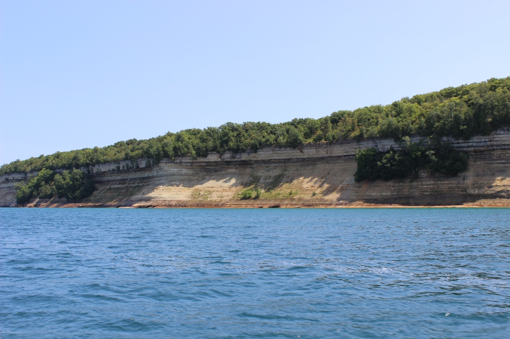
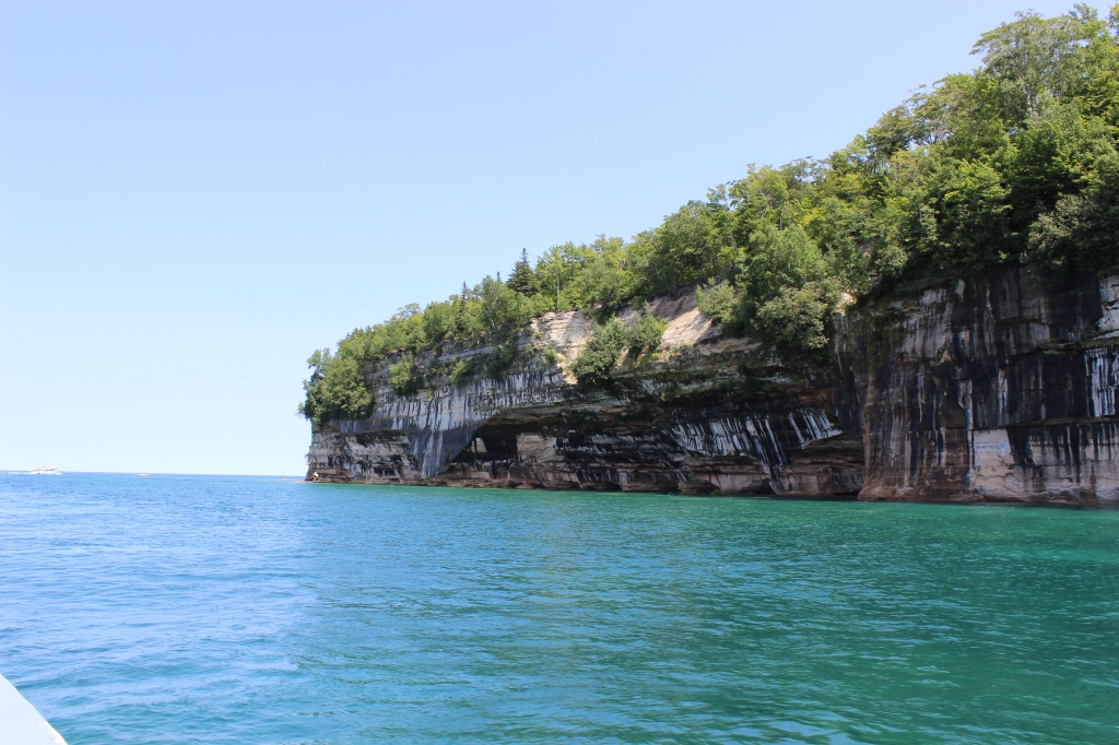
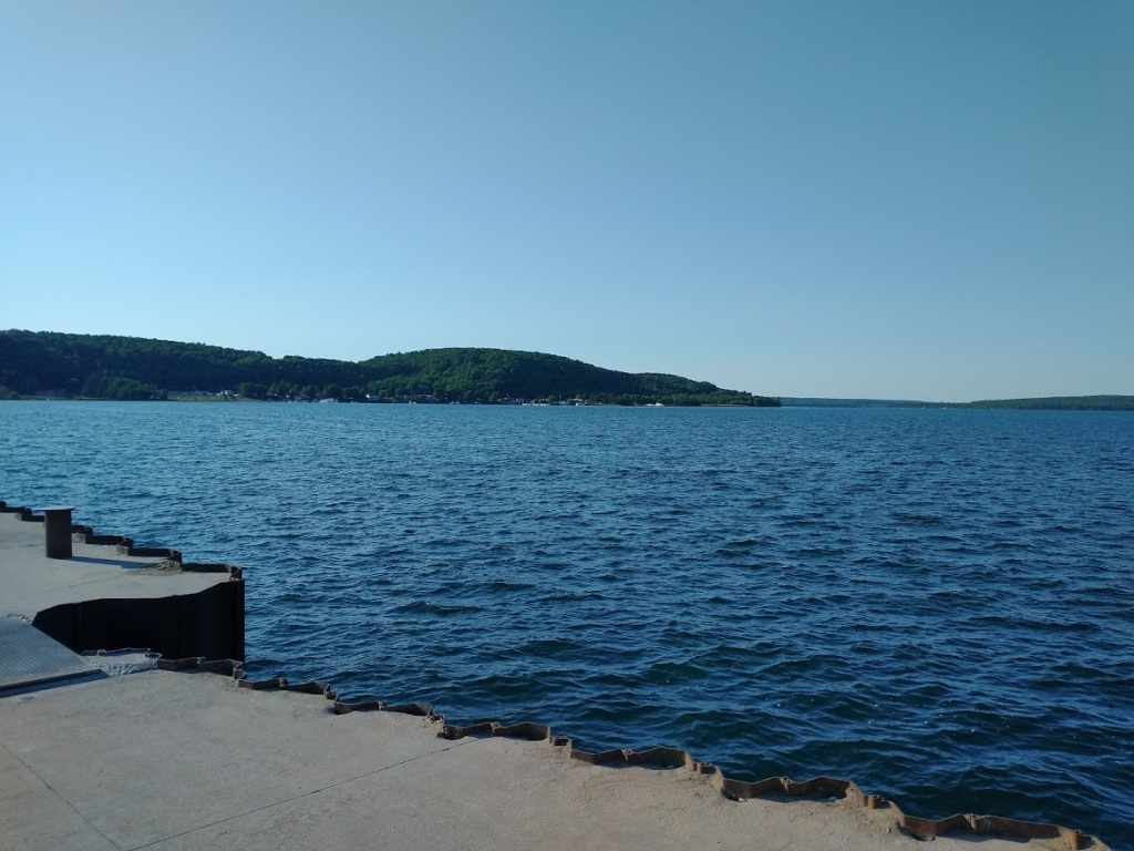
Once everyone is aboard, the boat pushes back from the dock ready for adventure. The first sight you will see is Munising High School, right on the water near the docks. The boat heads north, to the mouth of the bay. On the starboard side (right) you will see just how far the sand bar at Sand Point Beach sticks out into the bay. The color of the water is lighter above the sand bar. When our tour went, there were two people far out on the sand bar, not too far from the boat. To port (left) is Grand Island that forms the protective bay for Munising. You will see more of Grand Island on the way back. Even while still in the bay, the cliffs of the pictured rocks begin. There are trees growing on the side of the cliffs here because Grand Island protects them from the strong winds off Lake Superior.
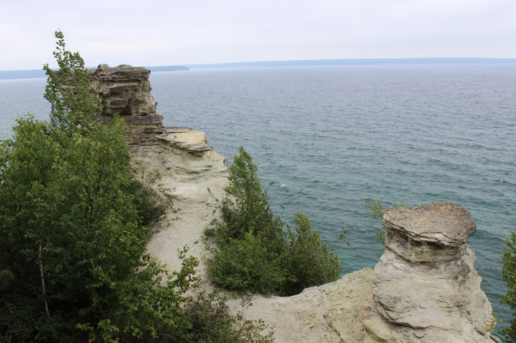
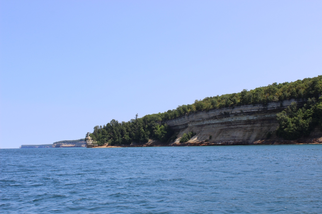
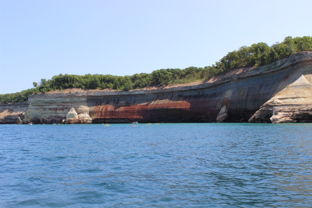
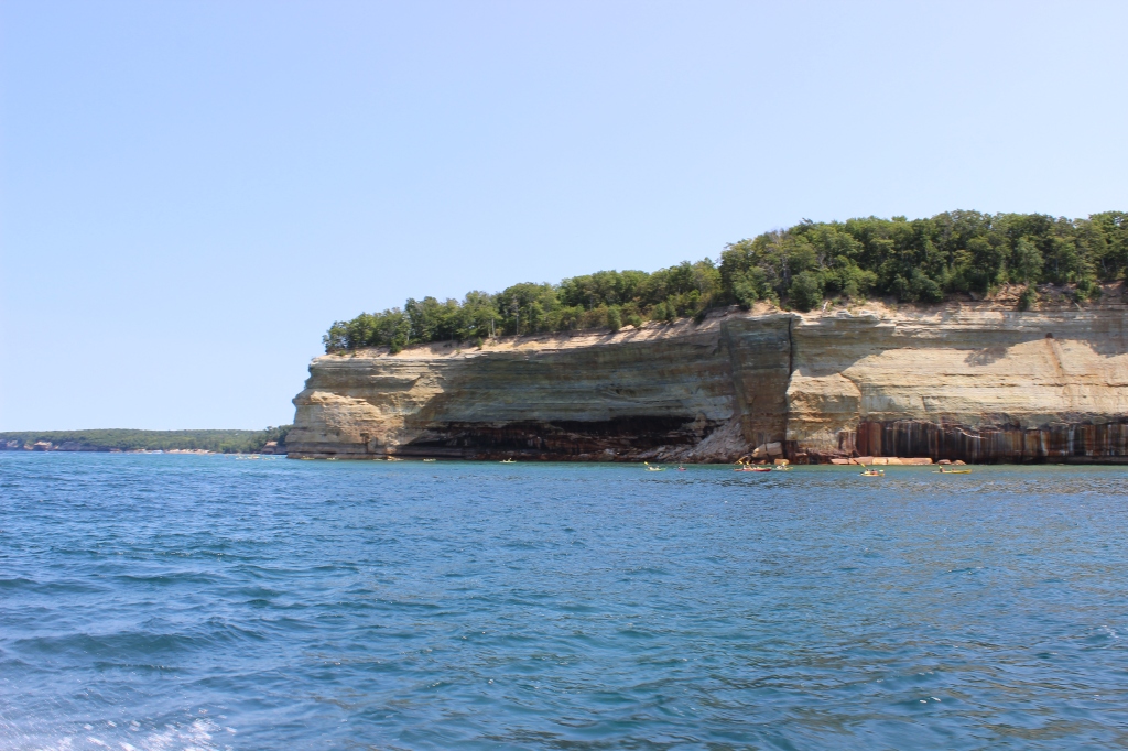
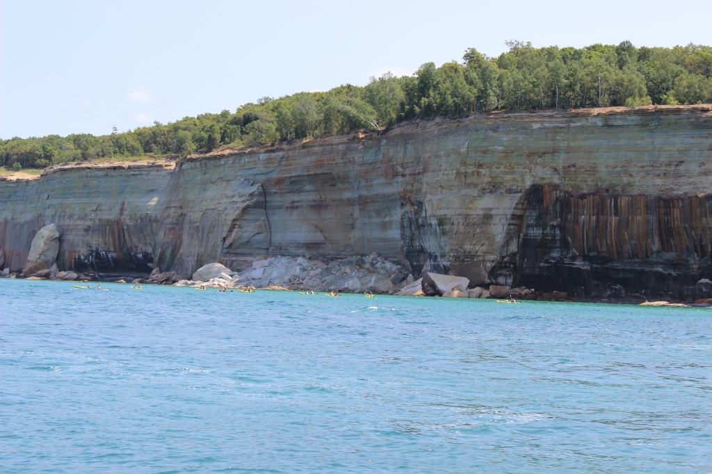
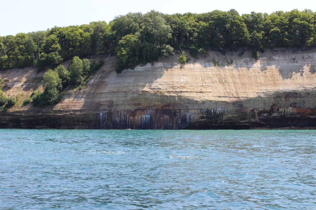
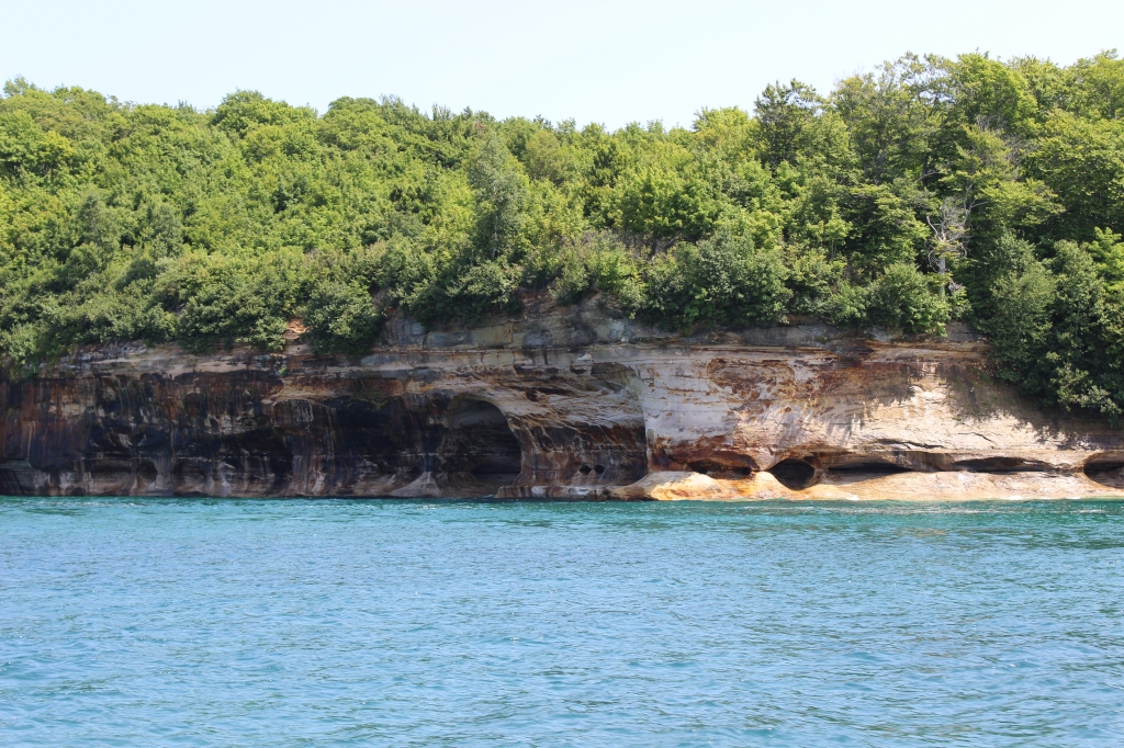
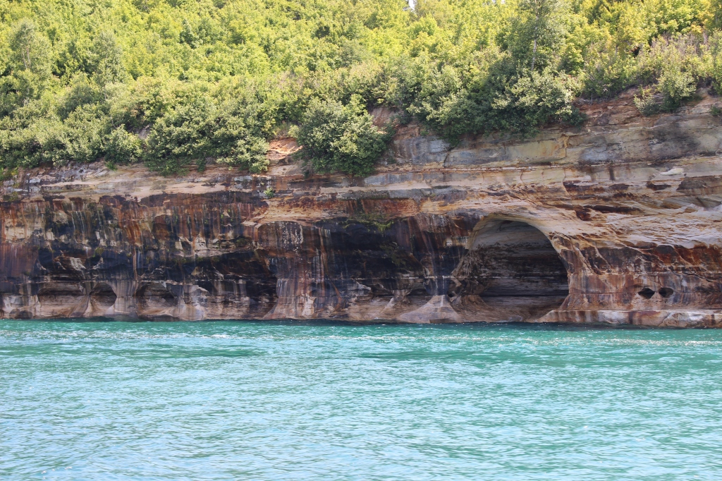
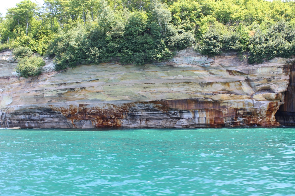
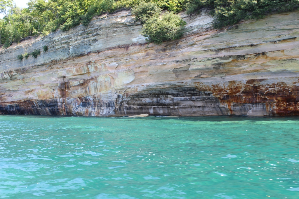
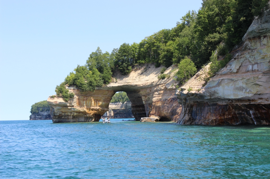
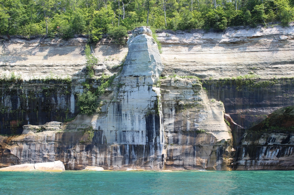
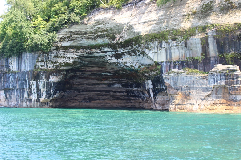
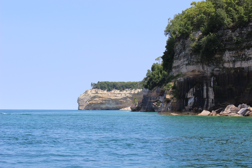
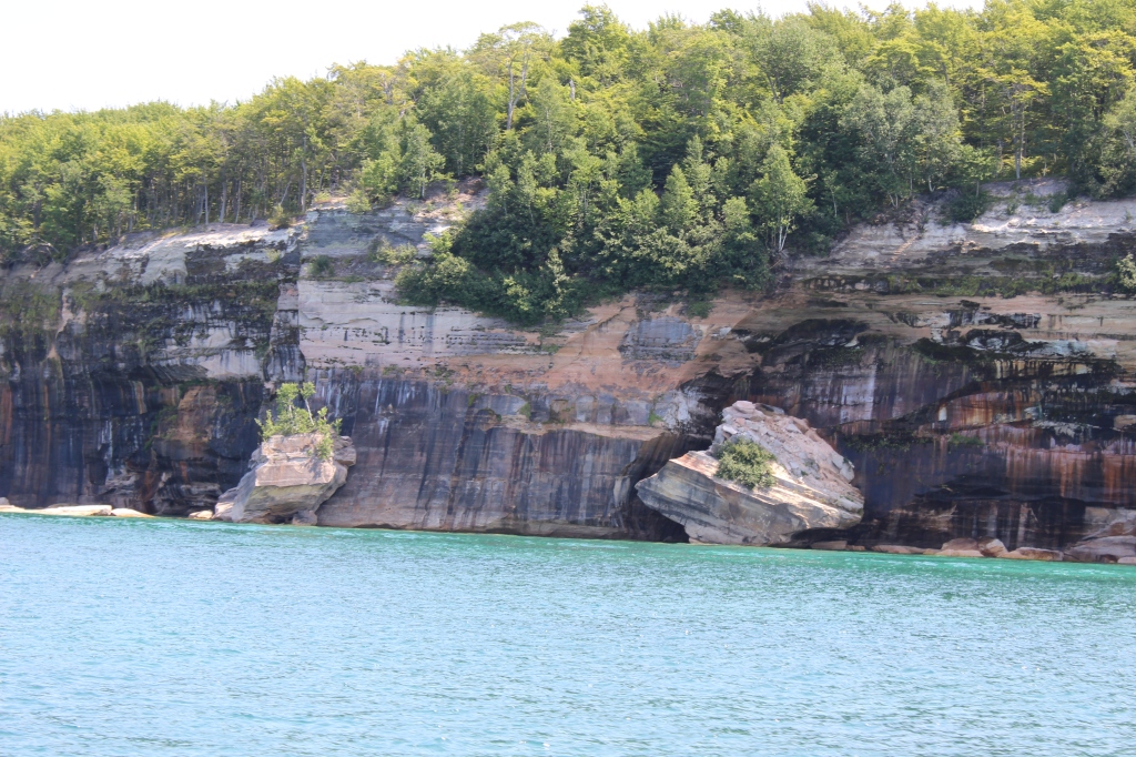
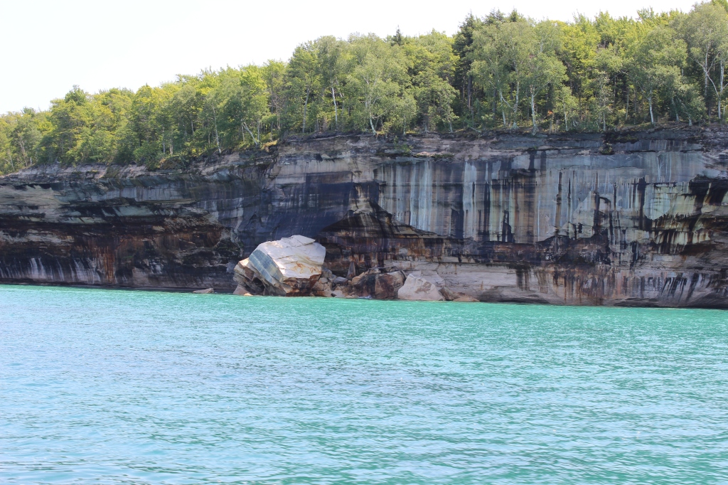
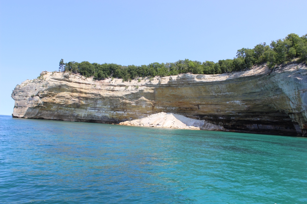
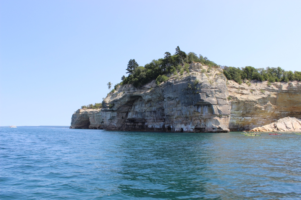
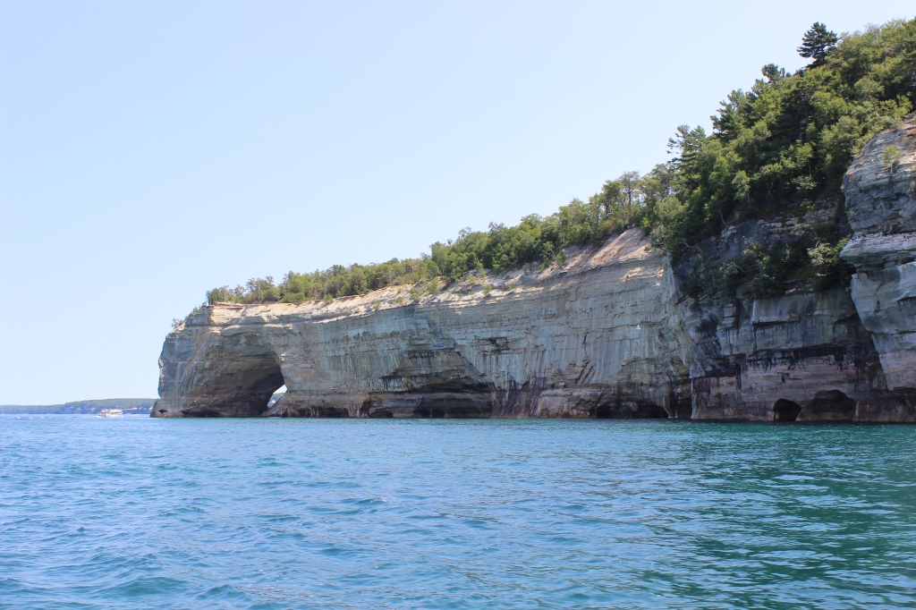
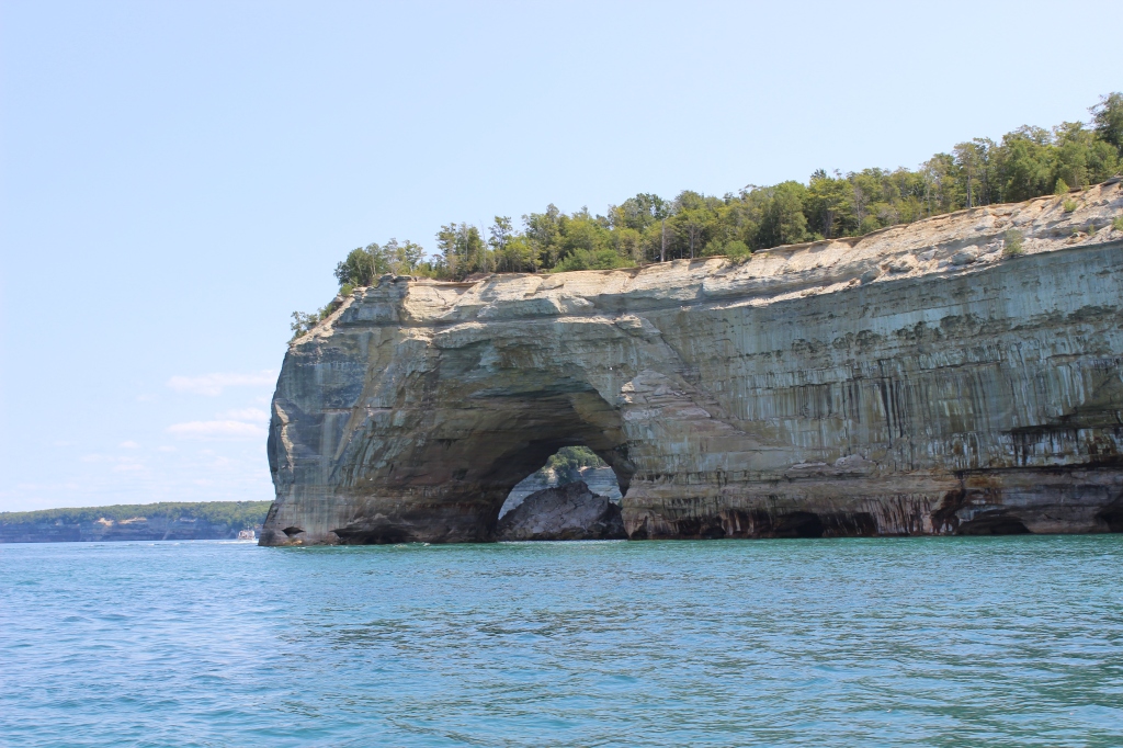
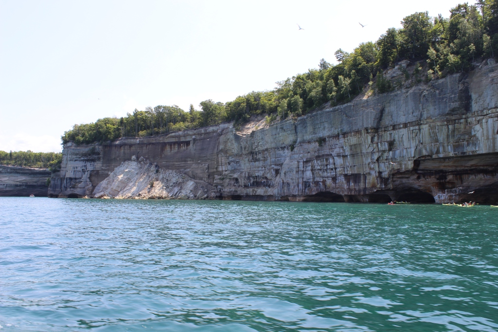
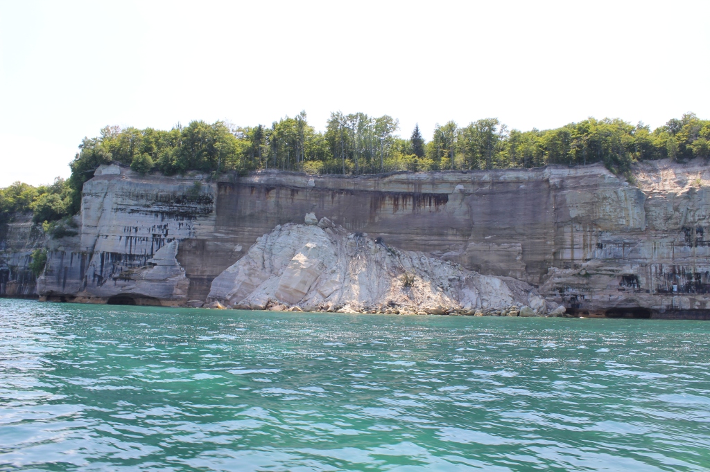
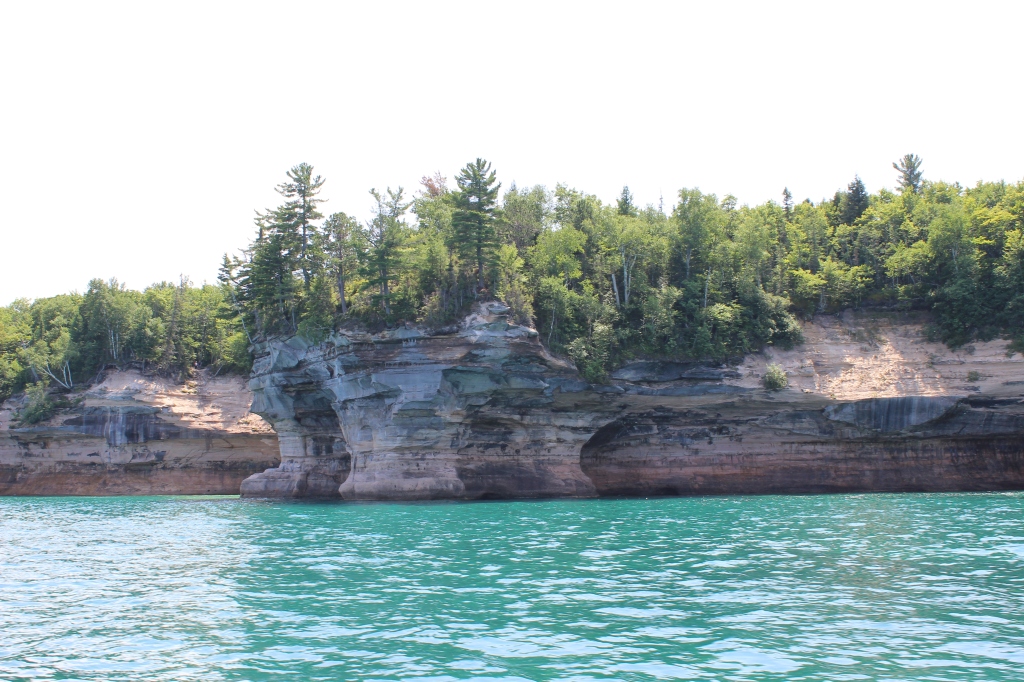
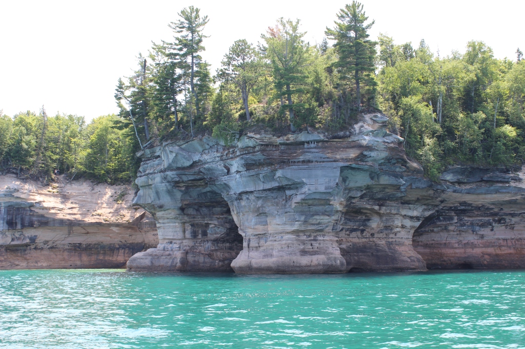
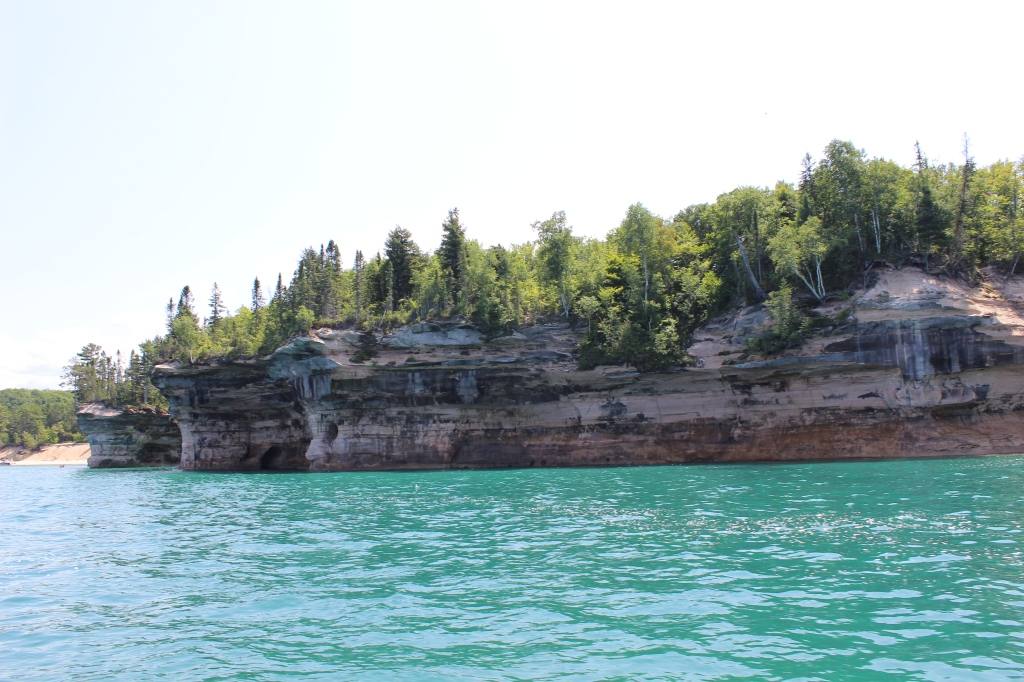
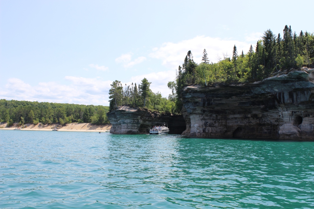
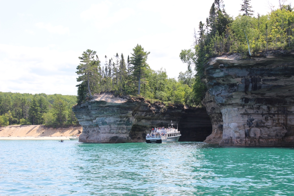
As the boat comes around the bend into open waters, Miner’s Castle comes into view. From the water, you can really see where this rock formation gets its name. Next comes Miner’s Beach at the break in the cliffs, equally as beautiful from the water as on the land. A little further down the coast, you will see the bare cliffs with the different layers of rock, telling the geological history of the area. As we continue down the shore, we encounter a stone archway in the rock that small boats and kayaks can go under. Later in the tour, we see a crevasse that the boat pulls into to get a close look at the cliffs. There are a few more landmarks on the tour. First is a formation that looks like a Native American chief from the side.
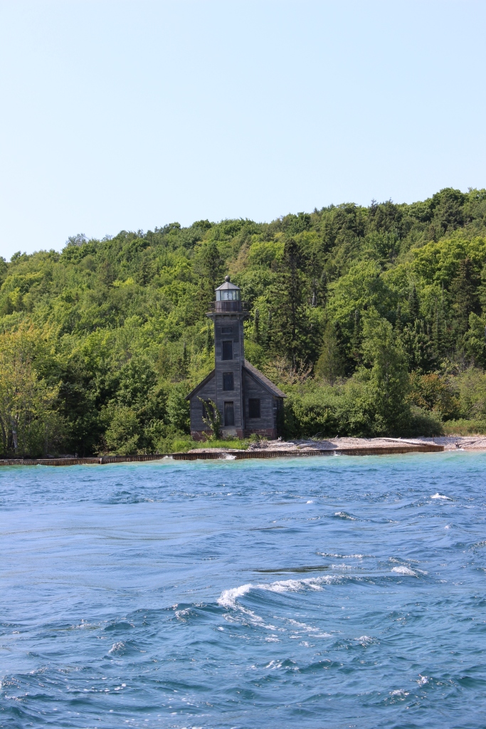
Another landmark you will see is Battleship row. There are numerous cliffs sticking out, all in a row, looking like the bows of battleships. After pulling out of the crevasse, the boat turns back to Munising so you can see it all again. Look in the opposite direction and you can see the majestic open waters of Lake Superior. On the way back into the bay, the boat goes closer to Grand Island. On the east end of the island, the boat brings us by the East Chanel Lighthouse. The lighthouse opened in 1868 at 45 feet tall -today the lighthouse is under restoration work.
All of the Pictured Rocks Lakeshore is spectacular, and it is hard at times to describe just how amazing it is. You just must visit. If you are in Munising, take the boat tour, you will not be disappointed. Now I will let my pictures do the talking.


Leave a Reply